For the descendents of Richard Dearie and his son John Russell
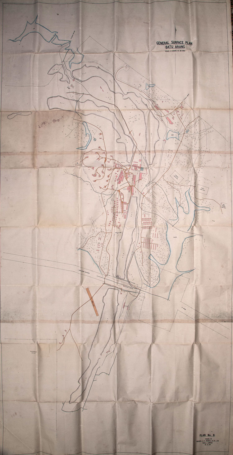
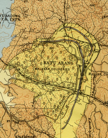
Batu Arang Map dated 18 April 1949. At the bottom is the railway station with the line from Batang Berjuntai on the left to Kuang on the right. The road to Kuala Lumpur can be seen between the two ponds on the top right hand side. The road to Rantau Panjang can be seen top left by a dam and pump house.
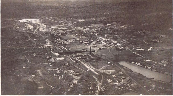
Below an aerial view of the colliery published in 1935 appears to be taken from the opposite direction to the map.
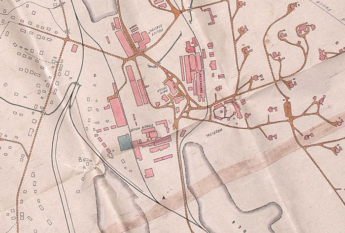
Below: Rotating the map it appears to match the aerial picture. The large group of buildings in the centre with a chimney and square "pond " to their left is the power house, the group of buildings to its right and father back, with a smaller chimney is the brick factory, the white building on the right the hospital. In front of the brickworks, and immediately behind the power house chimney, is the main office, and on the left of that the police station. On the hill up to the right are the European bungalows.
View Plan No. 8, Batu Arang 18.4.1949 in a larger map
Left: the main features of the 1949 map are marked on a Google map. Click on the link below the map to read the key. Some of these locators are approximate since there are too few features left on the ground to identify the sites accurately.
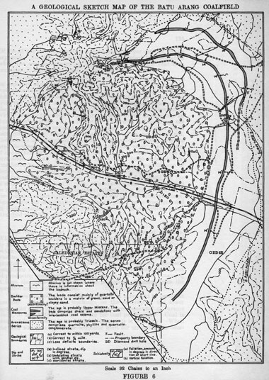
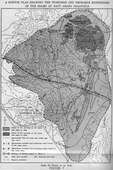
Three maps from "The Geology and Mineral Resources of the Neighbourhood of Kuala Selangor and Rasa, Selangor, Federation of Malaya, with an account of the geology of Batu Arang Coalfield" by F. W. Roe. Published in 1953 but based on surveys made in 1941 and 1942.